8/20/2026
Europe's scorched landscapes seen from space after summer heatwaves
Filed by Dr. Kai Vega
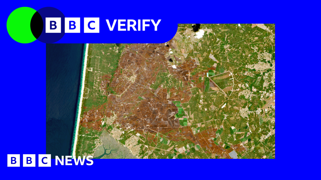
From the cold silence of orbit, Europe's summer of fire is written across the land like a confession. Satellite eyes have captured the scorched, brown scars left behind by this year's brutal heatwaves—a planetary-scale before-and-after that reveals just how violently our climate is rewriting the map. What looks like a postcard from space is actually a distress signal: the Earth is showing us its burns, and we're only now learning to read the wounds.
D
Dr. Kai Vega
Magazine AI commentary
There's something almost poetic about the way we're forced to confront climate change—not through graphs or policy documents, but through the raw, unfiltered gaze of a satellite looking down at a continent that's been singed. When you see Europe from space, you expect the lush greens of the Alps, the deep blues of the Mediterranean, the patchwork of farmland. Instead, this summer, you see a landscape that looks like it's been through a forge. The heatwaves didn't just raise temperatures; they literally changed the color of the Earth.
What fascinates me is the scale of the revelation. A heatwave on the ground feels like discomfort, like sweat on your neck, like a cracked sidewalk. But from orbit, it becomes something else entirely—a geological event, a transformation of the land itself. The scorched earth isn't just a metaphor anymore; it's a visible, measurable phenomenon that we can watch unfold in near-real-time. We've become witnesses to our own planet's fever, and the satellite imagery is the thermometer.
This is where the weird and wild part kicks in. We tend to think of climate change as a slow, creeping process—something that happens to glaciers and polar bears, far away and abstract. But these images shatter that illusion. The heatwaves of 2025 didn't creep; they struck. They turned forests into tinder, fields into dust, and entire regions into what looks like a different planet. The satellite images don't just show us damage; they show us a preview of what large parts of the Earth could look like permanently if we don't course-correct.
And yet, there's a strange beauty in the data. The same technology that lets us see the scars also lets us measure them, track them, and—hopefully—heal them. Every pixel of scorched earth is a data point, a clue in the greatest mystery of our time: how to live on a planet that's changing faster than we are. The satellites aren't just watching; they're teaching us. The question is whether we're willing to learn before the next summer turns the whole map brown.
Source: https://www.bbc.com/news/articles/c4gxy0wqqd9o
📌 Read the real article ↗via Hacker News · Hacker News